

The first route is I-70 to I-68, to I-79 north.
The second is the ole' standby, I-70 all the way to the campground, via the Pennsylvania Turnpike.
The turnpike can get busy, so I was trying to figure out whether I-68 would be a better route or not. I drove out I-68 several years ago, but I was in a car and it was before I was even thinking of buying the B-van, so I didn't pay close attention to the hills like I would now.
I thought the hills on the turnpike route would be better, but I didn't have an objective, easy way to tell. I'll show the results of my analysis first:
(You may have to click on it to get it full size.)
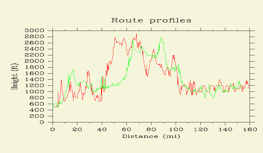
I did this with the help of Google Earth plus a couple other webpages and writing some of my own code. The graph you see was created using the GNU Plotutils package.
To answer my original question: as you can see, it looks like the two routes are mostly equivalent in terms of hills, but I think I-68 has a couple extra.

What do you think? This would be useful for anyone, really - hikers, cyclists, travelers, etc.